- CSS News
- Environmental Resource Assessment & Management
Tracking Fish Through Restored Habitat
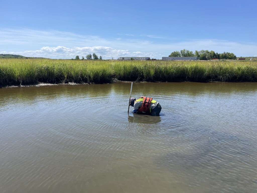
Poplar Island, a severely eroded remote island in the Chesapeake Bay, has been the site of a major restoration effort supported by CSS client, NOAA’s National Centers for Coastal Ocean Science (NCCOS), and their partners, Army Corps of Engineers, and the Maryland Department of Transportation, Maryland Port Administration. This massive effort utilizes dredge sediment from the shipping channel that leads to Baltimore Harbor to restore land mass lost to sea level rise and erosion. The goal is to rebuild natural habitats including wetlands, uplands, and embayments that provide critical habitat for birds and fish of the Chesapeake Bay. NCCOS and CSS scientists are studying this restored habitat and species that use the environment to help inform this restoration effort.
CSS employee owners work alongside federal program staff and local partners to collect samples throughout the regions. In fiscal year 2024 CSS staff deployed to the Gulf of Mexico and Pacific Ocean, which includes Alaska, Hawaii, and the West Coast. The team adds data they collect during these missions to the Coastal Pollution Data Explorer, a cloud-based ArcGIS platform that allows users to search by location or type of contaminant, generate a report, and download the data. A CSS employee owner serves as the lead developer for this online platform. Learn more about NOAA’s National Mussel Watch Program.


See More CSS Insights
Emergency Response Support for the Republican National Convention
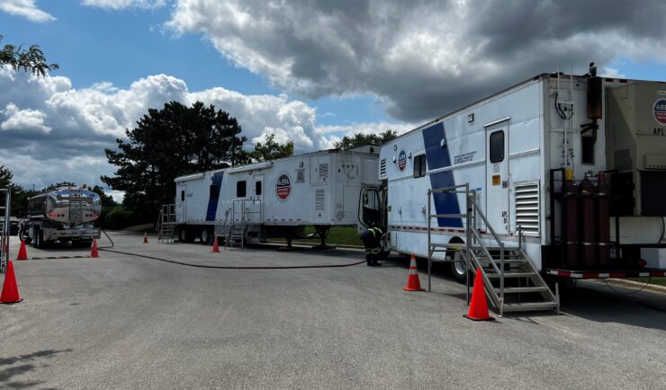
CSS employee owners on contract with the U.S. Environmental Protection Agency’s Portable High-throughput Integrated Laboratory Identification System — a mobile analytical unit known as PHILIS — provided emergency response support for the 2024 Republican National Convention. PHILIS mobile laboratory units are designed to provide onsite analysis of environmental conditions, including air and soil samples, contaminated…
Advancing Severe Weather Predictions with Artificial Intelligence
As artificial intelligence (AI) and machine learning (ML) technologies evolve in Earth sciences, CSS employee owners (formerly Riverside staff) are growing our expertise in this field. CSS employee owners are advancing technologies for our client, NOAA’s Center for Satellite Applications and Research (STAR). Our staff have developed a framework, exploiting modern AI/ML techniques, to rapidly…

Developing a Database for Ecosystem Service Models
CSS scientists have been major developers and contributors to the online U.S. Environmental Protection Agency’s EcoService Models Library (ESML) database since its inception in 2012. The ESML database contains detailed but concise descriptions of ecosystem service models to facilitate the selection of models by ecosystem scientists for a variety of management and research applications. The…