- Community Spotlight
- Environmental Resource Assessment & Management
Major Overhaul and Update to an Existing Tool
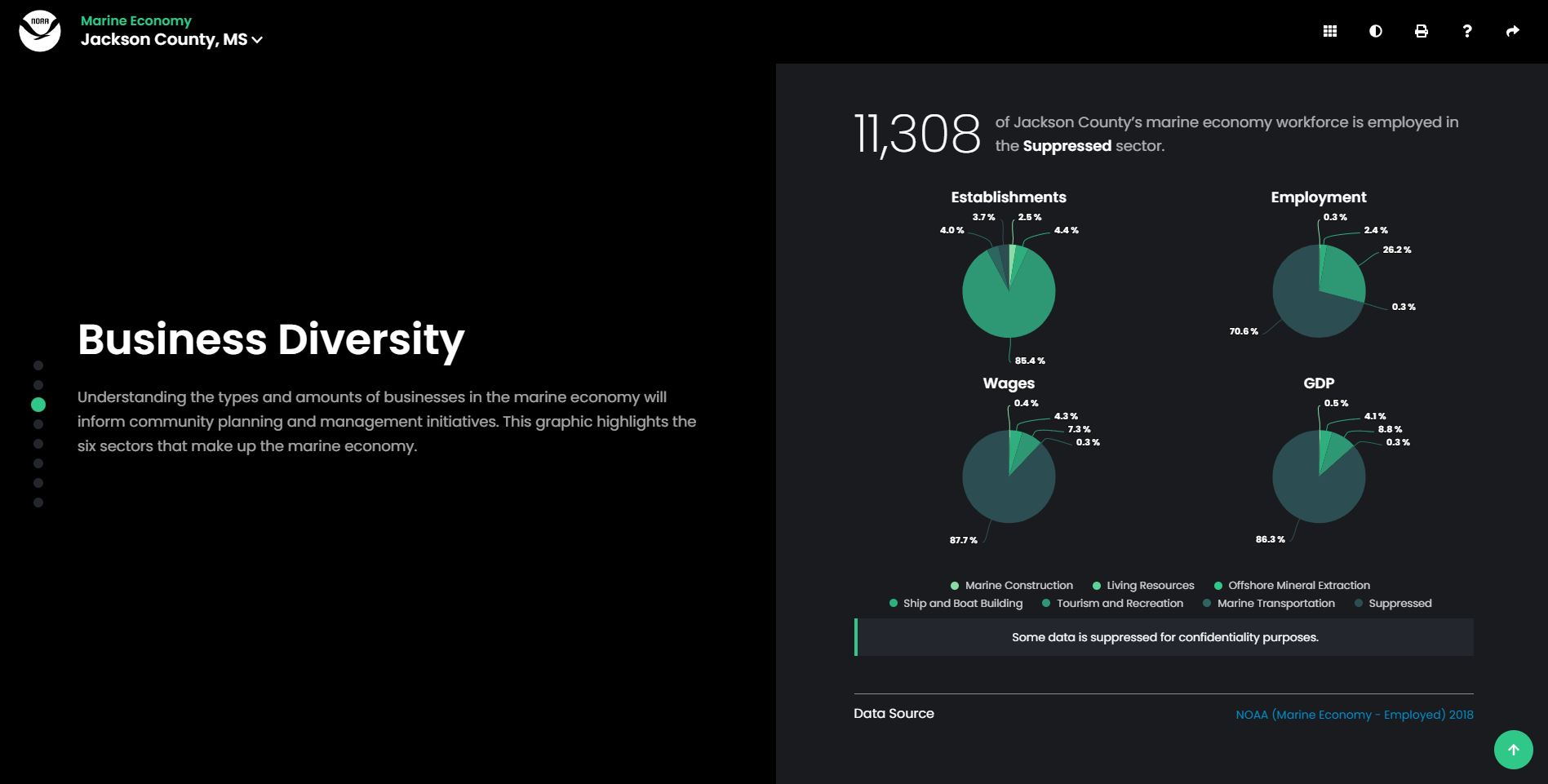
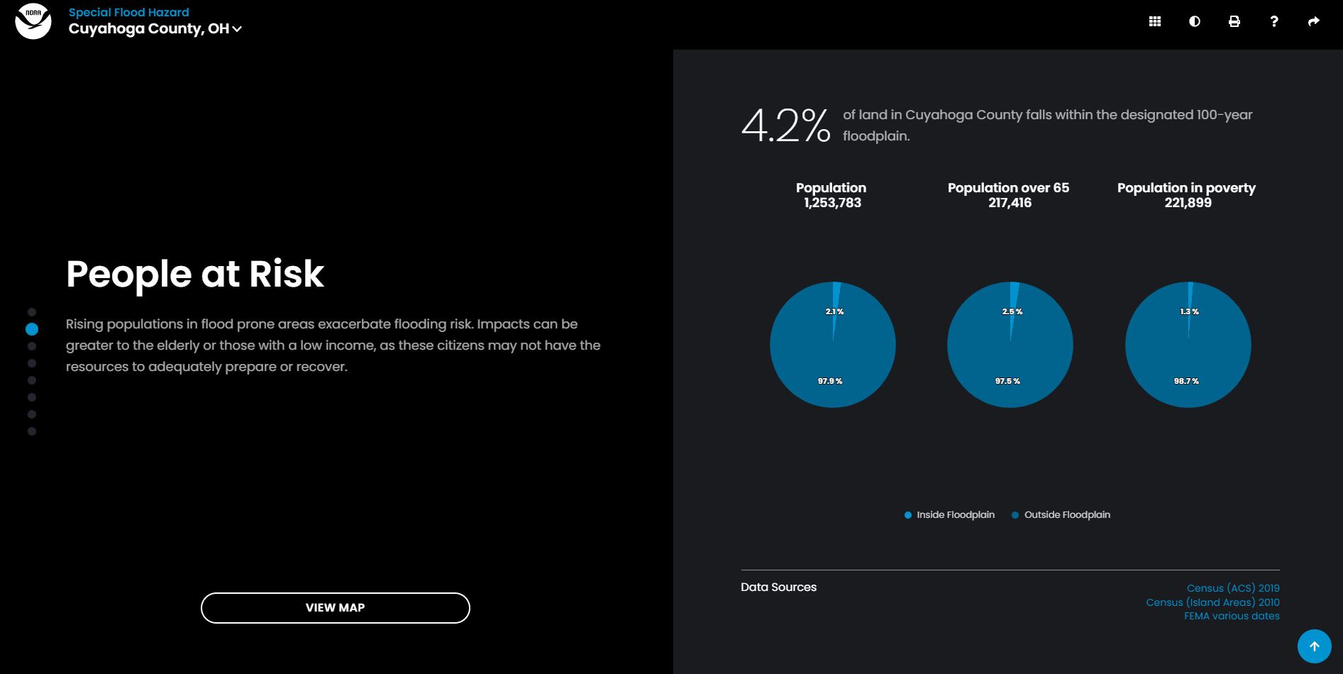
Congratulations to our staff on the highly anticipated new release of Coastal County Snapshots! Our staff are part of a larger team that includes the prime contractor, Lynker, Inc, and federal staff from the National Oceanic and Atmospheric Administration’s Office for Coastal Management who worked for over a year to complete this major task. Coastal County Snapshots provides county-level flood hazard, critical facility, job, and business data in an easy to understand format. The new version of the tool includes more contextual information, a more interactive interface, and two new snapshots not previously included: Total Coastal Economy and Sea Level Rise. Our staff provided data management, content development, and outreach support for this tool during this release and on a continuous basis.
Explore your Coastal County Snapshots.
See More CSS Community Spotlight
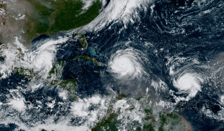
Supporting Hurricane Preparedness and Response
June 1 marks the beginning of hurricane season, but CSS employee owners work throughout the year to help communities prepare for and respond to hurricanes year-round. Through several contracts, CSS helps clients develop tools and content and manage data to provide resources communities and decision-makers can use for hurricane preparedness and response. Explore a few…
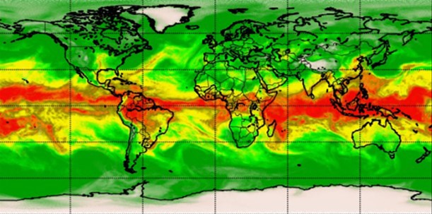
Advancing Severe Weather Predictions with Artificial Intelligence
As artificial intelligence (AI) and machine learning (ML) technologies evolve in Earth sciences, CSS employee owners (formerly Riverside staff) are growing our expertise in this field. CSS employee owners are advancing technologies for our client, NOAA’s Center for Satellite Applications and Research (STAR). Our staff have developed a framework, exploiting modern AI/ML techniques, to rapidly…
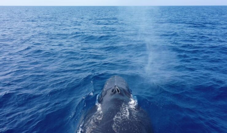
Training Marine Mammal Programs to Use Drones to Collect Dolphin and Whale Respiratory Health Data
CSS employee owner and Marine Mammal Drone Specialist supports NOAA’s National Centers for Coastal Ocean Science (NCCOS) Marine Mammal Health Assessment team with collecting respiratory health data from marine mammals in local waterways. Using specialized drones equipped with petri dishes provides a non-invasive method to collect exhaled breath (i.e. blow) samples from dolphins and whales.…